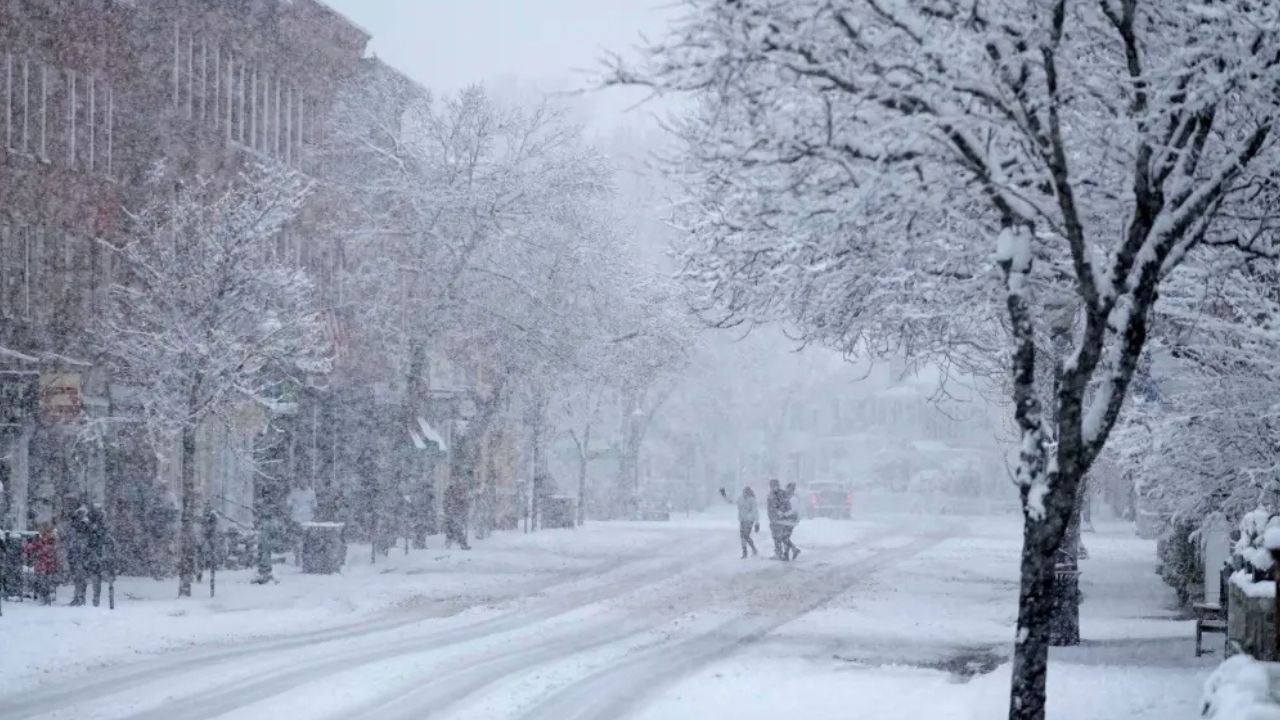
Cheyenne, Wyoming — A sharp and powerful weather shift is underway across southeast Wyoming as a strong Arctic cold front pushes through the region, bringing plunging temperatures, renewed snow chances, and dangerously low wind chills that could linger through the weekend.
Forecasters say this system marks one of the coldest stretches of the season so far, with conditions turning increasingly hazardous for outdoor activity, travel, and livestock as the cold settles in.
Strong Cold Front Ushers in Bitter Air
According to the National Weather Service office in Cheyenne, the cold front is expected to move through Thursday, triggering a rapid drop in temperatures across Laramie County and surrounding areas.
Daytime readings will struggle to climb out of the single digits and teens, while overnight lows are forecast to fall below zero in many locations. The coldest period is expected late Friday into early Saturday.
“Wind chills may bottom out near −25 degrees during the coldest mornings,” forecasters warned.
Even during daylight hours, wind chill values are expected to remain below zero, limiting any meaningful relief from the cold.
Wind Chills Create Serious Health Risks
The combination of strong winds and Arctic air will make it feel significantly colder than the actual temperature. Meteorologists say prolonged exposure could quickly lead to frostbite or hypothermia, especially during the overnight and early morning hours.
“Wind chill values are likely to stay below zero even during the day,” the Weather Service noted, “which increases the risk for anyone spending extended time outdoors.”
Residents are urged to dress in multiple insulating layers, cover exposed skin, and limit outdoor activities during peak cold periods.
Snow Chances Return Friday
Along with the cold, snow chances return Friday, as cloud cover increases behind the front. While forecasters are not yet confident in exact snowfall totals, even light snow could become problematic due to the extreme cold.
Important impacts to watch for include:
- Slick roads and icy surfaces
- Reduced visibility during snow showers
- Limited melting, even during the day
Because pavement temperatures will remain extremely cold, any snow that falls is expected to stick immediately, increasing the risk of hazardous travel conditions.
Read Also: High-Impact Winter Storm Set to Bring Snow, Ice, and Dangerous Cold Coast to Coast
Prolonged Cold Through the Weekend
The cold pattern is expected to persist through at least Sunday, keeping temperatures well below seasonal averages.
Forecast highlights include:
- Highs: Single digits to teens
- Lows: Below zero in many areas
- Wind chills: Subzero throughout much of the day
This extended duration of cold raises concerns beyond personal safety, including risks to pipes, vehicles, pets, and livestock.
“The prolonged nature of this cold makes preparation especially important,” forecasters said.
Gradual Improvement Early Next Week
Some moderation is possible by Monday, but the improvement will be slow. While daytime temperatures may inch upward, cold mornings are expected to continue, and any snow cover could delay warming even further.
Residents should not assume an immediate return to normal conditions early next week.
How to Prepare for the Cold
Officials recommend taking proactive steps now to reduce risks during this Arctic outbreak.
Key precautions include:
- Protecting exposed plumbing to prevent frozen pipes
- Checking vehicles, including batteries and antifreeze
- Ensuring pets and livestock have adequate shelter and warmth
- Keeping emergency supplies on hand, including blankets, food, and water
Travelers should allow extra time, monitor road conditions, and avoid unnecessary trips during periods of snow or extreme cold.
Stay Alert as Conditions Evolve
Forecasters emphasize that snowfall details and wind chill values may still change as the system moves fully into place. Additional advisories or warnings may be issued if conditions worsen.
Residents across Cheyenne and southeast Wyoming are encouraged to stay weather-aware, monitor official updates, and take cold-weather safety seriously through the weekend.
Share how you’re preparing for the cold or what conditions are like in your area in the comments below.