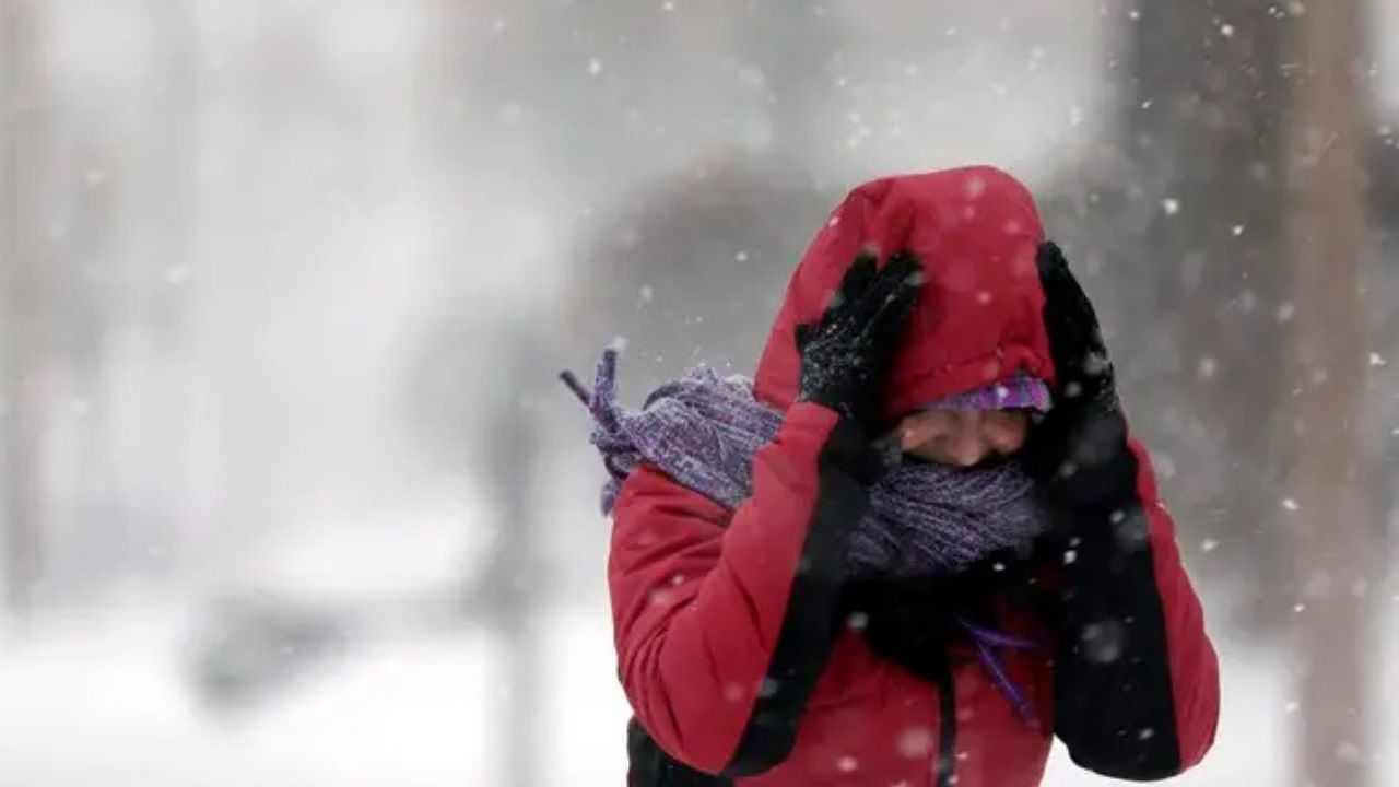
Raleigh, North Carolina — As parts of the South continue digging out from a historic ice storm, forecasters are now warning of a new and potentially dangerous winter system developing along the East Coast. A rapidly intensifying bomb cyclone is expected to bring blizzard conditions, destructive winds, heavy snow, and coastal flooding to portions of the Carolinas and southern Virginia this weekend.
The timing is especially concerning, as thousands of residents across the region remain without power following last week’s storm, compounding risks tied to extreme cold and prolonged outages.
South Still Recovering as New Storm Approaches
The incoming system arrives while recovery efforts are ongoing across several Southern states. More than one million customers lost electricity during last week’s ice storm, which has been linked to dozens of cold-related deaths.
As of this weekend, over 140,000 customers remain without power across Mississippi and Tennessee, according to utility data. Crews continue working under difficult conditions as cold temperatures persist.
In Tennessee, Nashville could see up to 3 inches of snow, with temperatures holding in the teens and 20s through Sunday, creating icy roads and slowing restoration efforts.
“We know that too many Nashvillians will remain without power coming into another storm this weekend,” said Freddie O’Connell, urging affected residents to seek alternative shelter before temperatures plunge again.
City officials confirmed that three people died in Nashville as a result of last week’s storm.
To support residents without heat, the Nashville Predators opened Bridgestone Arena as a temporary warming and shelter site.
Carolinas and Southern Virginia Face the Worst Impacts
Meteorologists say the most severe weather from the bomb cyclone is expected Saturday into Saturday night, with North Carolina and southern Virginia squarely in the high-impact zone.
Snowfall rates could reach 1 inch per hour, while winds exceeding 35 miles per hour may create blowing snow and whiteout conditions, especially in coastal and near-coastal areas.
Blizzard conditions are possible from the northeastern Outer Banks northward through Norfolk and Virginia Beach, where visibility could drop sharply during the height of the storm.
“This weekend, snow and bitterly cold temperatures are expected across much of North Carolina, and strong tides and high winds could cause flooding along the coast,” wrote Josh Stein, urging residents to prepare ahead of time.
Coastal Flooding and Erosion Prompt Closures
Along North Carolina’s Outer Banks, officials have already announced preemptive beach closures due to the threat of dangerous surf, coastal flooding, and erosion.
Read Also: Houston Braces for Hard Freeze as Temperatures Near I-10 Could Drop Into the Teens Sunday Morning
Portions of Cape Hatteras National Seashore have been closed ahead of the storm. The region remains highly vulnerable after 27 homes have collapsed since 2022 because of ongoing coastal erosion.
Sixteen of those collapses occurred between September and October 2025, largely affecting the Buxton and Rodanthe communities.
Ahead of the storm, closures include:
- Sections of Rodanthe from East Point Drive south to Surfside Drive
- Areas from the north end of Buxton to near off-road vehicle ramp 43
Offshore, a Hurricane Force Wind Warning is in effect for waters extending 100 nautical miles from Cape Hatteras to Cape Fear, underscoring the intensity of the system.
Northeast Braces for Wind and Coastal Impacts
Farther north, much of the I-95 corridor and the Northeast is expected to avoid significant snowfall from this storm. However, strong winds, coastal flooding, and beach erosion remain major concerns.
Cities including New York City, Philadelphia, and Washington, D.C. may miss out on accumulating snow, even as cleanup continues from last week’s winter storm — which dumped the most snow many areas have seen in nearly five years.
Economic Toll of Relentless Winter Weather
Experts estimate that last week’s storm alone caused between $105 billion and $115 billion in total damage and economic losses, highlighting the financial strain of repeated winter extremes.
“This is the harshest winter many Americans have faced in the past five to eight years,” a meteorologist said. “Relentless rounds of Arctic air outbreaks and wintry weather have been a dangerous and expensive combination.”
Heating costs are expected to remain exceptionally high for millions of households from Texas to Tennessee and much of the East Coast, adding to the burden as another major storm unfolds.
Officials Urge Immediate Preparation
Emergency managers across the Carolinas and Virginia are urging residents to finalize preparations now, including securing loose outdoor items, avoiding unnecessary travel during peak storm hours, and checking on vulnerable neighbors.
With blizzard conditions, hurricane-force offshore winds, coastal flooding, and extreme cold all possible from a single system, officials warn that this storm could be high-impact even for areas that avoid heavy snow.
How is your area preparing for the bomb cyclone, and are you still dealing with power or storm damage from last week? Share your local updates in the comments below.