Sacramento, California — Large parts of the western United States have entered early 2026 facing a snow drought, a situation that may seem contradictory after weeks of intense storms and record-setting rainfall. But experts say the very storms that brought flooding and landslides to the region also made the snow drought worse, raising long-term concerns for water supplies across the West.
Scientists explain that despite recent atmospheric river storms dumping enormous amounts of precipitation, much of it fell as rain instead of snow, preventing the mountain snowpack from building when it matters most.
What exactly is a snow drought?
A snow drought occurs when the snowpack holds far less water than normal for a given time of year. Hydrologists measure snowpack not by depth alone, but by how much water is stored within the snow, known as snow water equivalent.
When that number falls well below historical averages, the region is considered to be in a snow drought.
“A region can be in a snow drought even during a wet winter if temperatures are too warm for snow,” researchers note.
This matters because mountain snowpack functions as a natural reservoir, slowly releasing water into rivers, farms, and cities during spring and summer.
According to the U.S. Geological Survey, up to 75% of the West’s annual water supply depends on melting snow rather than direct rainfall.
Why rain can be worse than no storm at all
Snow droughts differ from traditional droughts. Instead of a lack of precipitation, they are driven by precipitation falling in the wrong form.
This winter, much of the West is experiencing what scientists call a “warm snow drought.” In these events, precipitation falls as rain during periods when snow would historically dominate.
As global temperatures rise, these warm snow droughts are becoming more frequent and more severe.
Atmospheric rivers and the December paradox
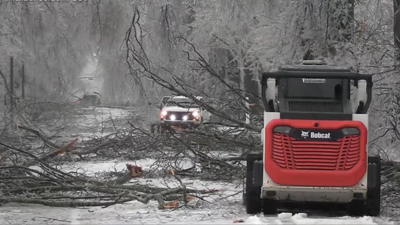
The risks of warm snow droughts were clearly visible in Washington state in early December 2025, when a powerful atmospheric river delivered record precipitation to the Pacific Northwest.
Between December 1 and December 15, some areas of the Cascade Mountains received up to 24 inches of precipitation, according to researchers at the Center for Western Weather and Water Extremes at Scripps Oceanographic Institute.
The storm caused:
- Flooding and landslides
- Damage to highways requiring months of repair
- Record flood levels at five stream gauges
- Major flooding at 16 additional sites
Yet paradoxically, regional water storage worsened after the storm passed.
How the storm reduced snowpack
Atmospheric rivers act like conveyor belts of tropical moisture, transporting warm, water-rich air northward. Combined with an unusually warm autumn across the West, the December storm produced rain at elevations where snow typically accumulates.
Data from CW3E showed that snowfall was mostly limited to elevations above 9,000 feet, leaving lower and mid-elevation watersheds exposed to heavy rain.
Read Also: California Finally Gets a Break After Weeks of Rain, Flooding, and Mountain Snow
That rainfall:
- Melted existing snow
- Accelerated runoff
- Reduced stored snow water
In the Yakima River Basin, researchers estimated that snowpack water storage dropped by roughly 50% during the event.
“Rain-on-snow events can remove water from the system at the worst possible time,” scientists explained.
Flooding now, shortages later
While rain provides immediate runoff, it does not replace snowpack. Instead of being stored for gradual release, the water rushes downstream, increasing flood risk while leaving less water available for summer.
This pattern creates a dangerous combination of:
- Short-term flooding
- Long-term water scarcity
- Higher risk of landslides
- Reduced reliability of water supplies
Is there still time for recovery?
The outlook is not entirely bleak. Experts say it is still early in the winter season, and the West’s primary snow-building months typically run from January through March.
Additional snowfall has already occurred in parts of the Yakima River Basin, restoring some lost snow water storage. However, snowpack levels remained well below historical averages as of early January 2026.
Preparing for a warmer future
Scientists and water managers are working to improve snow drought forecasting, aiming to predict impacts weeks or even months in advance. Researchers are also focusing on understanding how individual storms divide precipitation between rain and snow.
Better forecasting is essential as warming temperatures increase the likelihood of rain-heavy winter storms.
As snow droughts become more common, this research will play a critical role in helping cities, farmers, water managers, and winter recreation industries adapt to a changing climate.
For the West, the message is increasingly clear: it’s not just how much precipitation falls, but how it falls that matters most.
Have you noticed less snow in your area this winter? Share what you’re seeing and how it’s affecting your community in the comments below.