New York City — A massive and historic winter storm is now sweeping across the United States, stretching more than 2,300 miles and affecting daily life for over 245 million people across 40 states. From crippling ice in the South to heavy snow targeting the Northeast, the multi-day system is unfolding in stages, with dangerous weather impacts expected to linger well into next week.
Meteorologists warn that this storm is not just about snow. Ice, severe thunderstorms, extreme cold, and prolonged power outages are all part of a complex system that continues to evolve as it charges eastward.
Friday: Storm Develops Across the Plains
The winter storm began taking shape midday Friday across the Plains, arriving earlier than many forecast models initially projected. Snow, freezing rain, and sleet quickly spread across parts of Texas, Oklahoma, and Arkansas, setting the stage for widespread disruption.
By Friday night, snow and ice blanketed large portions of the Southern Plains, leading to hazardous driving conditions and early power outages as ice accumulated on power lines and trees.
Officials warned that early icing could “create long-lasting impacts due to the weight of ice on infrastructure.”
Saturday: Ice and Snow Slam the South
On Saturday, the storm pushed deeper into the Southeast, expanding its reach and intensity. Mississippi, Alabama, Georgia, and the Carolinas began experiencing significant ice accumulation and snow, especially in northern and interior regions.
Power outages became increasingly likely as ice thickened across roadways and electrical infrastructure. Travel conditions deteriorated rapidly, with many highways becoming impassable.
At the same time, strong to severe thunderstorms developed across portions of the eastern Gulf Coast.
Southern Louisiana, Mississippi, Alabama, the Florida Panhandle, and southwest Georgia faced damaging wind gusts exceeding 60 mph, with the threat of isolated tornadoes.
Several areas were placed under a Level 2 out of 5 tornado risk, adding yet another hazard to an already dangerous weather setup.
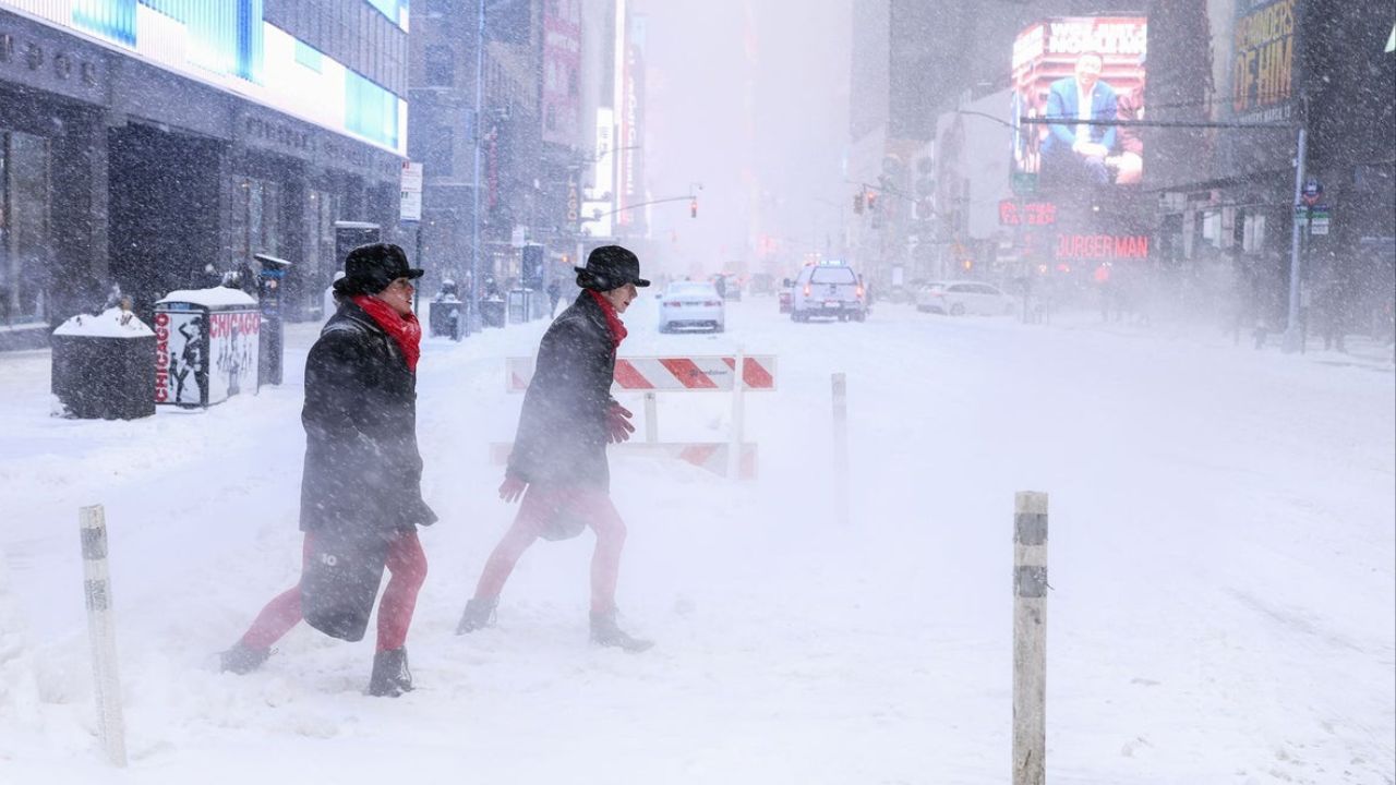
Sunday: Northeast Braces for Major Snowfall
By Sunday, attention shifted north as the storm surged toward the Mid-Atlantic and Northeast. **es.
Winter Storm Warnings were issued across much of the region, including Washington, D.C., Philadelphia, New York City, and Boston, with alerts expected to remain in effect through Monday.
Forecasters say this system could deliver the most significant snowfall the I-95 corridor has seen in years, with snow intensifying throughout the day.
“This has the potential to be a high-impact event for major metro areas along the East Coast,” meteorologists cautioned.
Snowfall rates may become heavy at times, severely limiting visibility and making travel nearly impossible.
Monday: Storm Winds Down, Cold Locks In
While the main storm system is expected to gradually weaken from west to east on Monday, the impacts will not end when the snow stops.
Extremely cold air will surge southward behind the storm, locking in snow and ice across affected regions. In the South, cities from Dallas to Little Rock could wake up to single-digit temperatures or even below zero, marking 30 to 40 degrees below normal for late January.
Read Also: Historic Winter Storm Triggers Nationwide Flight Disruptions, San Diego Travelers Urged To Prepare
In the Northeast, snow may continue across portions of New England into Monday evening as the storm pulls away from the coast.
Persistent Freeze Creates Long-Term Hazards
As the system departs, Extreme Cold Warnings and Watches will remain in effect across large portions of the Upper Midwest, Plains, and Northeast.
Major cities under cold alerts include Minneapolis, Detroit, Boston, and New York City, where wind chills may make temperatures feel even colder.
Across the Southeast, the cold will linger into midweek.
Cities such as Atlanta, Raleigh, and Wilmington are expected to see temperatures running 15 to 20 degrees below average, with daytime highs struggling to reach freezing.
Overnight lows are forecast to drop into the 20s and teens through Tuesday and Wednesday, increasing the risk of black ice as any daytime melting refreezes overnight.
Officials warn that refreezing conditions could significantly delay power restoration and recovery efforts in ice-hit areas.
Ongoing Risks and Power Concerns
With frigid air spreading nationwide, power outages remain a major concern, particularly in areas impacted by ice accumulation. Utility crews are preparing for extended restoration efforts as dangerous cold complicates repair work.
Residents across affected regions are urged to limit travel, monitor local alerts, and prepare for prolonged disruptions as this historic winter storm continues its march across the country.
How is the storm unfolding where you live? Share your experience and preparation plans in the comments below.