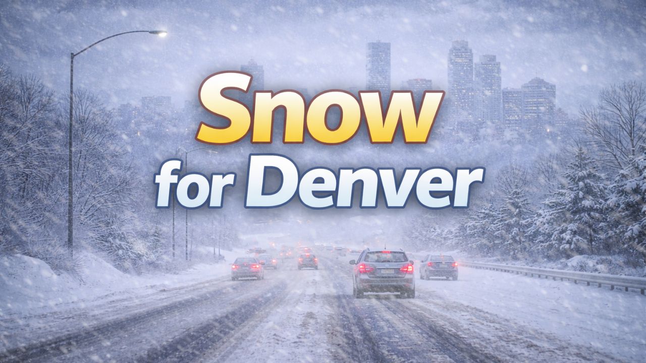
Denver, Colorado — A fast-moving winter storm is set to sweep across Colorado over the next 12 hours, bringing accumulating snow to Denver and the Front Range and creating hazardous travel conditions through Thursday night and early Friday.
Forecasters say the system will move quickly, but its timing during commute hours and a sharp temperature drop could still cause significant disruption.
Meteorologists caution that snowfall totals may vary widely over short distances, depending on how the storm evolves overnight.
Snow spreads from the mountains to the Front Range
Snow will begin expanding across Colorado’s high country Wednesday evening, with radar gradually filling in as the storm strengthens. As precipitation pushes east toward the Front Range overnight, some lower elevations may briefly see rain or a rain-snow mix before colder air allows snow to take over.
By the Thursday morning commute, widespread snow is expected along the I-25 corridor, including downtown Denver. Snow is forecast to continue through Thursday afternoon and evening before tapering off from northwest to southeast later in the day.
According to the National Weather Service, this storm’s quick pace means conditions may change rapidly, especially during peak travel times.
“Even a fast-moving system can create major impacts when it coincides with commutes and falling temperatures,” forecasters noted.
Dry air could limit or boost snowfall totals
One of the key uncertainties with this storm is the intrusion of dry air from the north and west. How far south that dry air pushes — and how strong it becomes — will determine whether snowfall totals trend toward the lower or higher end of forecasts.
If the dry air advances farther south or becomes stronger than expected, snowfall amounts will be reduced. If it remains weaker or stays farther north, totals could come in higher across the metro area.
Read Also: Weather Update: Juneau’s Record Snow Crisis Worsens With Rain on the Way
“This is a classic ‘boom or bust’ setup for the Front Range,” forecasters said.
Expected snowfall amounts across the region
At this point, forecasters say 1 to 4 inches of snow remains a reasonable expectation for much of the Front Range, including Denver.
East of Denver and across the plains, 1 to 2 inches of slushy accumulation is likely. With marginal temperatures, significant melting is expected during daylight hours, meaning many locations may end up on the lower end of snowfall totals.
Higher elevations are expected to see more impactful snow:
- Foothills and Colorado Springs: 3 to 6 inches
- Palmer Divide (south of Castle Rock): Up to 10 inches possible
- Vail Pass and near the Eisenhower Tunnel: 5 to 10 inches
- Lower-elevation mountain locations: 4 to 8 inches
These totals could lead to snow-packed and slick conditions on mountain passes and higher-elevation roadways.
Travel impacts to peak Thursday into early Friday
Travel impacts are expected to be greatest during:
- Thursday morning commute
- Thursday evening commute
- Early Friday morning
While roads may appear wet or slushy during the day, conditions are expected to deteriorate rapidly after sunset.
Temperatures will fall sharply Thursday night, dropping into the teens and low 20s across much of the region. Any moisture left on roadways is likely to refreeze, leading to icy conditions, especially on bridges, overpasses, and untreated roads.
“Refreezing will be a major concern Thursday night into early Friday,” forecasters warned.
Road conditions are expected to improve significantly after sunrise Friday, as temperatures climb and crews continue treatment.
Advisories and watches in effect
Winter Weather Advisories and Winter Storm Watches have been issued for portions of the high country and areas south of the Denver metro, reflecting the higher snow totals expected in those regions.
Drivers heading into the mountains or traveling along the Palmer Divide are urged to check conditions frequently and be prepared for winter driving.
What residents should keep in mind
Officials recommend taking the following precautions:
- Allow extra travel time Thursday and early Friday
- Slow down on snow-covered or icy roads
- Be cautious after dark, when refreezing is most likely
- Check road conditions before traveling, especially in the mountains
Even though this storm will move out relatively quickly, its timing and temperature drop make it a notable midweek winter event.
Looking ahead
Once the storm exits, conditions are expected to improve by Friday afternoon, with drier weather and better travel conditions heading into the weekend.
Still, forecasters remind residents that January storms along the Front Range often produce uneven impacts, and small changes in storm track or temperature can lead to big differences in snow totals.
How is the snow impacting your area or commute? Share what you’re seeing on the roads in the comments below.