Marquette, Michigan — Winter has tightened its grip on Upper Michigan as lake-effect snow, strong winds, and bitter cold combine to create dangerous travel conditions across the Marquette area. Forecasters warn that blowing snow and sudden whiteouts could make driving hazardous with little notice, particularly on untreated roads.
A Winter Weather Advisory remains in effect through 1 p.m. Wednesday, with conditions expected to remain challenging even after the advisory expires.
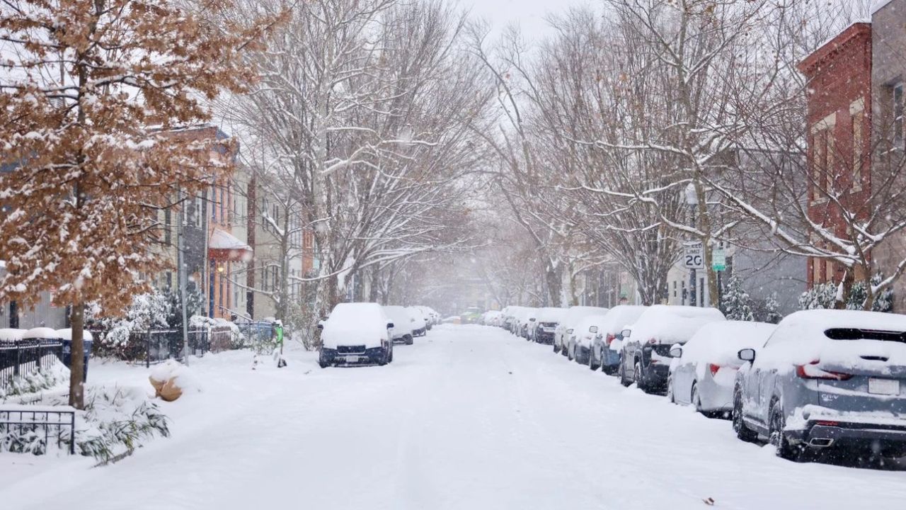
Lake-Effect Snow Piles Up Across the Snowbelt
According to the National Weather Service, persistent lake-effect snow bands continue to impact Marquette and surrounding counties, especially areas north of US-41.
Forecasters expect 3 to 5 inches of snow, with locally higher amounts possible in the most snow-prone locations. Snow has been falling in bursts, reducing visibility quickly when bands intensify.
“Lake-effect snow will continue through the day, with periods of reduced visibility and slick road conditions,” forecasters said.
Gusty Winds Create Blowing Snow and Whiteouts
Strong northwest winds gusting up to 45 mph are significantly worsening conditions. The combination of fresh snow and powerful winds is leading to widespread blowing and drifting, making it difficult for drivers to see lane markings or upcoming hazards.
Key travel concerns include:
- Sudden whiteout conditions
- Rapidly changing visibility
- Snow-covered and drifting roadways
Even roads that were previously plowed can become snow-covered again within minutes.
Bitter Cold Adds Another Layer of Risk
Temperatures across the region remain near the teens, with wind chills well below zero. Officials say the cold makes it dangerous to spend extended time outdoors and increases the risk for anyone stranded due to vehicle trouble.
“With wind chills below zero, even short exposure can become dangerous,” forecasters warned.
The cold also means that any brief melting during lighter snow periods will refreeze quickly, raising the risk of black ice on roads, bridges, and parking lots.
Snow Continues, Then Briefly Eases Tonight
Snow showers are expected to continue through Wednesday afternoon before easing slightly overnight. Despite the decrease, slick pavement will remain a concern, as temperatures stay well below freezing.
Drivers are urged to remain cautious even during lulls in snowfall, as conditions can deteriorate again without warning.
Short Break Possible Thursday — But Not for Long
Thursday may offer a brief improvement, with snow chances decreasing during the day and mostly cloudy skies. High temperatures are expected to struggle to reach the upper teens, limiting any meaningful improvement to road conditions.
While some roads may improve temporarily, officials caution that conditions remain fragile, particularly as another round of snow approaches.
Snow Chances Return Thursday Night Into Friday
Snow showers are forecast to increase again Thursday night into Friday, potentially impacting both morning and evening commutes. While accumulations appear lighter than Wednesday’s snowfall, even minor amounts could remain disruptive given cold pavement temperatures.
“Another period of snow showers could impact travel late this week,” forecasters said.
Winter Pattern Holds Through the Weekend
Looking ahead, the winter pattern shows no signs of letting up. Snow showers are expected to linger into the weekend, with overnight lows dipping into the single digits.
Wind chills are forecast to remain harsh, and untreated surfaces are likely to stay slick, especially during overnight and early morning hours.
Read Also: Record Snowfall Forces Massive Cleanup at Juneau School After Historic Winter Storm
Five-Day Outlook for Marquette
- Thursday: Mostly cloudy, slight chance of snow, high near 18°F
- Friday: Snow showers likely, high near 26°F
- Saturday: Snow showers likely, high near 21°F
- Sunday: Chance of snow showers, high near 13°F
- Monday: Snow showers likely, high near 11°F
What Residents Should Keep in Mind
Important reminders for Upper Michigan residents:
- Allow extra time for travel
- Reduce speeds during blowing snow
- Watch for sudden visibility drops
- Prepare for extreme cold if traveling
Officials encourage residents to monitor updated forecasts and road conditions closely as winter weather continues to impact the region.
How are conditions where you live right now — are roads improving or still snow-covered? Share your local updates and experiences in the comments below.