Chicago, Illinois — A prolonged stretch of wintry weather is taking hold across much of the United States this week, with repeated surges of Arctic cold, ongoing lake-effect snow, and the growing threat of a high-impact winter storm later this week. Forecasters say the pattern could deliver the coldest air of the season so far for millions, with impacts stretching from the northern Plains to the Southeast and East Coast.
Bitter cold grips multiple regions early this week
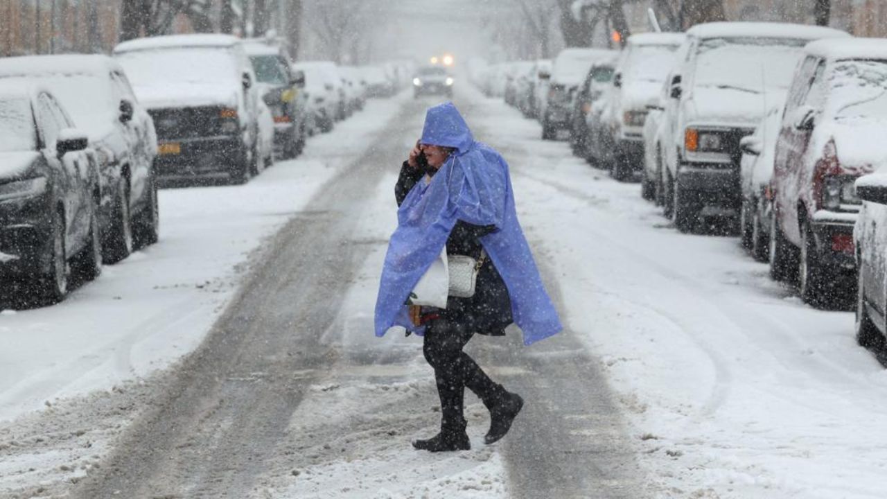
The week began with widespread cold alerts affecting an estimated 77 million people across two large zones — one spanning from the northern Plains through the Midwest and into the Northeast, and another unusually reaching deep into Florida.
Wind chills early Monday dropped to 20 to 30 degrees below zero in northern cities such as Chicago and Albany, New York. At the same time, Florida cities that rarely experience such cold, including Tampa and St. Petersburg, saw wind chills plunge into the 20s and 30s.
Although Florida’s cold alerts were expected to expire by midmorning, temperatures there remained 10 to 25 degrees below normal through the afternoon.
Monday marked the coldest day of the week for the Upper Midwest and Great Lakes, while Tuesday is expected to be the coldest day for the Northeast. In New York City, wind chills are forecast to remain in the single digits and teens for much of the day.
Lake-effect snow creates dangerous conditions
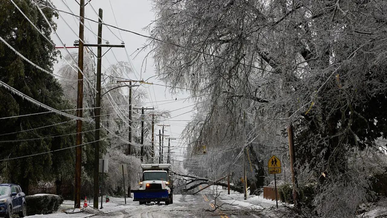
Alongside the cold, lake-effect snow intensified across traditional snowbelt areas downwind of the Great Lakes.
By Monday afternoon, more than 8 inches of snow had fallen in parts of Michigan and New York, with snow bands expected to persist through Tuesday near Lakes Michigan, Erie, and Ontario.
The hazardous conditions were blamed for a massive 100-vehicle pileup near Grand Rapids, Michigan, forcing authorities to shut down Interstate 196 in both directions for several hours.
Clippers add light snow midweek
Beyond lake-effect snow, a clipper system is forecast to dive out of Canada on Tuesday, spreading another round of snow across:
- The Dakotas
- Minnesota, including light accumulation in Minneapolis
- Iowa
On Wednesday, the same system is expected to race across the Great Lakes, bringing a light dusting to Chicago early in the day before spreading snow into the interior Northeast and New England later on.
While these systems will reinforce winter conditions, forecasters say snow totals through midweek should remain modest, and temperatures, though very cold, are not expected to break records during this initial phase.
Read Also: Boston Weather Forecast: Arctic Cold Battles Powerful Winter Storm With High-Stakes Weekend Outcome
Bigger threat emerges late week
Attention is increasingly shifting to a second, more serious winter threat expected to arrive later this week.
Beginning Friday, another powerful blast of Arctic air is forecast to push into the northern Plains and Upper Midwest, then expand south and east through the Plains, Midwest, Southeast, and Northeast over the weekend.
- Widespread wind chills near 30 below zero
- Localized wind chills of 40 to 50 below zero in the coldest areas
- Below-zero wind chills spreading across parts of the Northeast and New England by Sunday
Meteorologists say this surge could deliver the coldest air of the season — and possibly the entire winter for many locations.
Winter storm potential grows
How far south the Arctic air presses will determine the scope of a developing winter storm that could affect the southern tier of the country from Friday through Sunday.
Current signals point to a high-impact system capable of producing:
- Snow and ice in the southern Plains
- Wintry precipitation across the lower Mississippi Valley
- Hazardous conditions in parts of the Southeast
There is also potential for snow and ice to push northward into the Northeast, though forecasters stress that confidence remains low on exact placement of precipitation types this far out.
Small shifts in storm track could dramatically change who sees rain, snow, or ice.
Officials begin risk messaging
Despite the uncertainty, meteorologists are confident enough to begin early risk messaging. Weather offices, including the National Weather Service Fort Worth, have warned of freezing temperatures and a potentially messy winter setup later this week.
Forecasters caution that even as model guidance improves, exact snowfall and ice amounts cannot yet be determined.
What to expect next
As the forecast sharpens over the coming days, it is becoming increasingly clear that the second half of January will be dominated by harsh winter conditions for much of the country.
Residents are urged to:
- Prepare for extreme cold
- Monitor forecasts closely
- Plan for possible travel disruptions
- Protect pipes, pets, and vulnerable individuals
From the Rockies to the East Coast, winter is poised to make a strong statement. Do you think your area will be impacted more by the cold, snow, or ice? Share what you’re expecting in the comments below.