Chicago, Illinois — A powerful surge of Arctic air is expected to sweep out of northern Canada later this week, driving dangerously cold temperatures across dozens of states and potentially delivering the coldest conditions of the winter so far for millions of Americans. Forecasters warn that the cold could expand as far south as Texas and spread east toward the Atlantic Coast as the weekend approaches.
Meteorologists say this outbreak has the potential to exceed the cold experienced in December, with temperatures plunging well below seasonal norms in many regions.
Arctic air mass builds and moves south
The frigid air is currently consolidating over northern Canada and is forecast to surge into the central United States by late week, before expanding southward and eastward through the weekend and early next week.
Dozens — and possibly hundreds of locations — could see temperatures drop several degrees below their typical January lows, especially across the Midwest and Plains.
“This is a classic mid-to-late January Arctic outbreak, when the coldest air of the season is climatologically most likely,” forecasters noted.
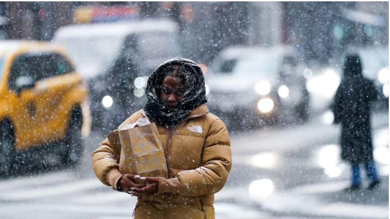
Extreme wind chills increase danger
The cold will not arrive alone. Gusty winds accompanying the Arctic air will dramatically lower how cold it actually feels outdoors.
According to AccuWeather, RealFeel® Temperatures — which factor in wind, humidity, sunshine, and precipitation — could plunge 10 to 30 degrees colder than actual air temperatures at times.
Important risks include:
- Frostbite on exposed skin within minutes
- Hypothermia, especially for those without adequate shelter
- Increased danger for elderly individuals and those with underlying health conditions
Coldest air targets Midwest first
From a scientific perspective, this outbreak is particularly notable for how far below normal temperatures may fall.
Forecast guidance suggests temperature departures of 10 to 40 degrees below average across parts of the Midwest on Friday.
Specific impacts may include:
- Minneapolis seeing high temperatures below zero
- Chicago potentially failing to rise above 0°F during the day
These conditions could mark the coldest air of the season so far for many northern cities.
Energy demand and infrastructure concerns
As temperatures plunge, energy demand is expected to spike, with an estimated 100 to 200 million people turning up their heat.
Officials warn that the strain on energy systems could be compounded if winter weather in the South brings freezing rain instead of snow, increasing the risk of long-lasting power outages.
“Ice-related outages combined with extreme cold can quickly become life-threatening,” experts cautioned.
Read Also: Fort Worth Stock Show and Rodeo Prepares for Potential Winter Weather
Southern storm could worsen impacts
The southward and eastward reach of the Arctic air will depend in part on the track and intensity of a developing southern storm system, which could bring snow, sleet, or freezing rain.
If freezing rain dominates in parts of the South:
- Power lines and trees could be damaged
- Restoration efforts may be slowed by the extreme cold
- Frozen pipes could become widespread
For residents who have so far avoided pipe damage this winter, officials say this outbreak could be the most serious test yet.
Snow and lake-effect precede the cold blast
In the days leading up to the main Arctic surge, clipper systems will continue to deliver light snow from the Midwest into the interior Northeast.
Cold air flowing across the Great Lakes will also trigger lake-effect snow, producing localized but intense accumulations.
Intermittent snow squalls are possible, creating sudden whiteout conditions and dangerous travel, particularly on highways.
Great Lakes ice expected to increase rapidly
As the frigid air passes over the Great Lakes, ice coverage is expected to grow quickly.
Once ice expands — especially on Lake Erie, which typically freezes first — lake-effect snow may gradually decrease. However, the upcoming cold could push ice coverage from below average to above average for this time of year.
Historically, Great Lakes ice coverage continues increasing into late February and early March, and this pattern appears likely to accelerate that process.
What residents should prepare for
With extreme cold and potential winter weather on the horizon, officials urge residents to prepare now.
Key precautions include:
- Protecting exposed pipes
- Limiting outdoor exposure
- Checking heating systems
- Preparing for possible power outages
- Ensuring pets and vulnerable neighbors are safe
Looking ahead
While some areas are already experiencing near-seasonal lows, forecasters say this is only a preview of what’s coming. The most intense cold is expected several days from now, with impacts lasting into early next week.
“This is shaping up to be one of the most widespread cold outbreaks of the winter.”
As forecast confidence improves, officials recommend closely monitoring updates and adjusting plans accordingly. Do you think your area is ready for this level of cold? Share how you’re preparing in the comments.