Buffalo, New York — A significant winter storm is gripping large portions of western and northern New York, bringing heavy snowfall, damaging wind gusts, and bitter wind chills that are expected to last through midweek and disrupt travel during the Martin Luther King Jr. Day holiday period.
According to the National Weather Service, a Winter Storm Warning remains in effect for multiple communities across the region as lake-effect snow bands intensify behind a surge of Arctic air. Forecasters warn that conditions may deteriorate rapidly at times, especially in areas prone to persistent snow squalls.
Heavy Snow Accumulation Targets Western New York
Communities across western New York are bracing for substantial snow totals, with some locations likely to see well over a foot of accumulation before the storm weakens.
Cities including Buffalo, Niagara Falls, Batavia, Jamestown, Olean, Warsaw, Orchard Park, Springville, and Medina are forecast to receive 10 to 20 inches of snow, with the highest totals expected in elevated terrain such as the Boston Hills, Buffalo Southtowns, and the northern Chautauqua Ridge.
Snowfall rates could become intense at times.
“Periods of snowfall may exceed one to two inches per hour, especially Monday and Tuesday,” forecasters said.
Farther north and east, including Oswego, Watertown, and Lowville, snow totals are expected to be lighter, generally ranging from 1 to 3 inches, though blowing snow may still create hazardous conditions.
Powerful Winds Increase Whiteout Risk
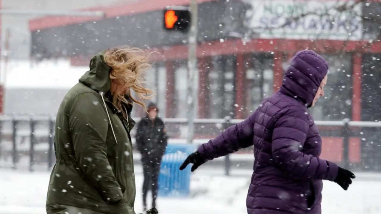
Strong winds are compounding the storm’s impacts across the region. Wind gusts approaching 50 mph are possible across much of western New York, while areas farther east may still experience gusts near 45 mph.
These winds are expected to blow and drift snow, significantly reducing visibility and making travel unpredictable.
“Whiteout conditions may develop quickly, creating travel that becomes dangerous or even life-threatening,” the warning states.
Drivers may encounter sudden near-zero visibility, particularly on open highways and rural roads.
Travel Conditions Expected to Be Hazardous
Transportation officials warn that road conditions may range from slick to impassable, depending on snowfall intensity and wind direction. In some areas, especially near Lake Erie and Lake Ontario, snow bands may persist for hours at a time.
Forecasters describe travel in parts of northern New York as “very difficult to impossible” during peak snow periods. Even areas outside the heaviest snow bands could see rapidly changing road conditions.
Residents are urged to delay unnecessary travel, carry winter survival supplies, and monitor local alerts closely.
Wind Chills Drop Well Below Freezing
While air temperatures will remain cold, the wind chill will be the most dangerous element of this storm. Wind chills across much of western New York are expected to range between 0°F and –10°F, with localized values near –15°F in higher terrain and areas south of Buffalo.
Read Also: Michigan Braces for Dangerous Arctic Blast as Wind Chills Drop to –35°F Early This Week
Extended exposure in these conditions can lead to frostbite within minutes, particularly on exposed skin.
Officials recommend dressing in layers, covering hands and face, and limiting time outdoors whenever possible.
Protecting Homes During Heavy Snow
Beyond travel and personal safety, homeowners are also being urged to remain alert for structural stress caused by snow buildup.
Heavy, wet snow can place excessive weight on roofs, increasing the risk of damage.
“Accumulated snow can strain roof supports and lead to sagging or interior damage,” home safety experts warn.
If it can be done safely, homeowners may consider using a roof rake to remove snow in stages, avoiding sudden shifts in weight. Clearing vents and ensuring proper attic ventilation can also help reduce ice-related issues.
Storm to Linger Through Midweek
The storm is expected to remain active through Wednesday, with lake-effect snow bands shifting but not fully breaking down until later in the week. The prolonged nature of the event raises concerns for snow fatigue, ongoing travel delays, and extended cold exposure.
Residents across affected areas are encouraged to stay informed, prepare for power interruptions in localized areas, and check on neighbors who may need assistance.
How is this winter storm affecting your area so far? Share your local conditions, snowfall totals, or travel concerns in the comments below.