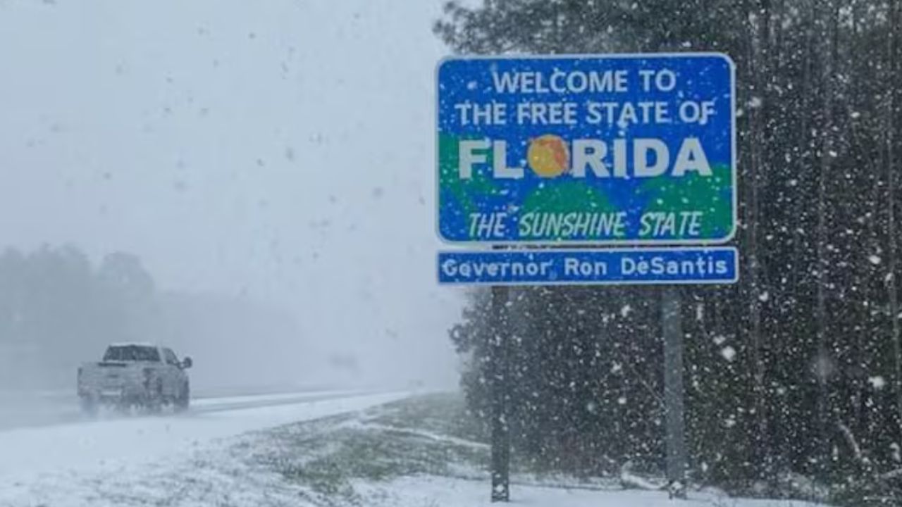
Florida Panhandle — Parts of Florida briefly traded sunshine for snow early Sunday, as a surge of Arctic air pushed far enough south to deliver a rare winter sight across the western Panhandle, marking the second year in a row the Sunshine State has seen measurable snow.
Light snow fell during the early morning hours as temperatures dipped just low enough behind a departing cold front to turn lingering rain showers into flakes. The snow was short-lived but striking, dusting grass, rooftops, and palm fronds in a region where snowfall is usually a once-in-a-generation event.
While the snow did not stick to roadways, residents reported thin coatings on lawns before the sun and slightly warmer air caused most of it to melt away by mid-morning.
“It was just enough cold air at just the right moment,” meteorologists said, noting that the timing of the front played a critical role in the unusual outcome.
A Rare Sight — Again
Sunday’s snowfall comes less than a year after a historic winter storm stunned the same region on Jan. 21, 2025, when some Panhandle communities recorded up to 8 inches of snow, the most significant accumulation in parts of Florida since the late 1800s.
That event shattered long-standing records and reshaped perceptions of winter weather in the Deep South. While this weekend’s snowfall was far lighter, its back-to-back occurrence has captured national attention.
Florida being snow-free for decades at a time is typical. Seeing snow in consecutive winters is not.
Social media quickly filled with photos and videos showing flakes on beaches, snow tucked into tropical landscaping, and children stepping outside to witness a phenomenon many Floridians have never seen firsthand.
Southern Snow Extends Beyond Florida
Florida was not alone in its brief winter transformation. Parts of southern Alabama and southern Georgia also reported snowfall, with some locations seeing more persistent accumulation than the Panhandle.
Cities such as Columbus and Macon, Georgia, reported snow-covered ground, prompting officials to issue travel advisories due to slick surfaces and limited snow-treatment infrastructure in the region.
“Even a small amount of snow can have a big impact in the South,” forecasters warned, emphasizing that road conditions can deteriorate quickly when temperatures hover near freezing.
Heavier Snow Targets the Northeast
While the South marveled at a dusting, a more familiar winter scene was unfolding farther north. Boston and much of New England braced for heavier snowfall as a coastal low-pressure system passed just offshore.
Forecasters expected 3 to 5 inches of wet, heavy snow across parts of Massachusetts, Connecticut, and Rhode Island, with impacts extending into the evening hours.
“There’s a low-pressure system passing offshore and it’s close enough to bring us some snow, but far enough away not to be a major hit,” said National Weather Service meteorologist Kyle Pederson.
The timing meant snowfall intensified after mid-afternoon, sparing early events but raising concerns for evening travel.
Read Also: Arctic Blast Brings Snow Chances to Tri-State This Weekend, Deeper Cold Follows Next Week
Cold, Not Snow, the Main Story in the Midwest
In Chicago, snow accumulation was expected to be minimal, but dangerously cold temperatures became the dominant concern. Afternoon highs struggled to climb out of the teens, with wind chills hovering near zero.
Meanwhile, the Upper Midwest faced far more severe conditions. A blizzard warning remained in effect for parts of Minnesota and North Dakota, where snow totals were modest but wind gusts approaching 55 mph threatened whiteout conditions.
“It’s not the snowfall, it’s the wind,” forecasters stressed. “Visibility can drop to near zero in seconds.”
Why This Keeps Happening
Meteorologists point to persistent Arctic intrusions and a wavering jet stream pattern that has allowed cold air to plunge deeper into the southern United States more frequently in recent winters.
Rain turning to snow in Florida requires a precise balance of timing, temperature, and moisture — and this winter delivered it again.
While experts caution against drawing conclusions from individual events, they acknowledge that rare winter extremes are appearing more often across regions not accustomed to them.
What Happens Next
Temperatures across the Florida Panhandle rebounded later Sunday, ending the snow threat quickly. However, forecasters say cold air remains entrenched across much of the eastern U.S., with additional winter systems possible in the weeks ahead.
Residents in southern states are urged to stay weather-aware, especially overnight when temperatures can drop faster than expected.
Florida may return to sunshine quickly — but after two winters in a row with snow, many are wondering whether this rare sight could become less rare in years to come.
Have you ever seen snow where you live in Florida or the Deep South? Share your experience and thoughts in the comments below.