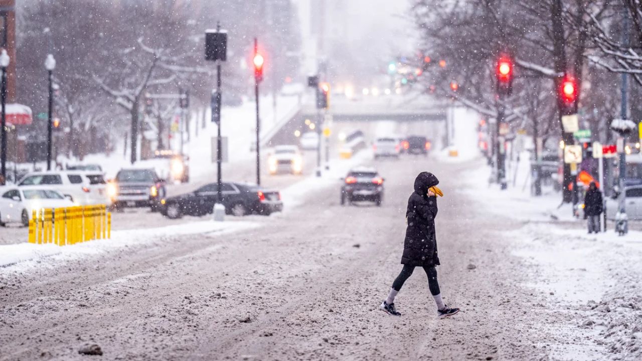
Fairbanks, Alaska — A developing winter storm is tightening its grip on Alaska’s Interior, with steady snowfall and gusty winds expected to impact Fairbanks and surrounding communities through Sunday night. Forecasters warn that travel conditions could deteriorate quickly as snow accumulates and visibility drops across highways, rural roads, and mountain passes.
The National Weather Service has expanded Winter Weather Advisories to now include the Fairbanks North Star Borough, as confidence increases in several inches of snow and periods of blowing snow through the remainder of the weekend.
Snowfall builds across the Fairbanks area
According to forecasters in Fairbanks, snowfall totals of 3 to 6 inches are expected across the Fairbanks metro area, beginning late Friday and continuing through Sunday night. While snowfall may briefly ease Saturday evening, additional snow is expected to redevelop overnight, extending impacts into the end of the weekend.
“Snow will continue in waves, with periods of reduced visibility possible, especially when breezes increase,” meteorologists cautioned.
Valley locations around Fairbanks could see breezy conditions, which may cause snow to blow across roadways and temporarily reduce visibility, particularly during heavier bursts of snowfall.
Advisories remain widespread across the Interior
Winter Weather Advisories remain in effect across much of Alaska’s Interior, covering a broad swath of communities and travel corridors. Conditions will vary by region, but accumulating snow and localized blowing snow are expected to be common themes.
In the eastern Alaska Range mountains, forecasters are particularly concerned about strong winds. East winds of 25 to 35 mph, with gusts reaching up to 45 mph, are expected through late Saturday night.
These winds could lead to:
- Blowing and drifting snow
- Rapidly changing visibility
- Hazardous travel through higher elevations and mountain passes
Drivers traveling through these areas are urged to use extreme caution, especially overnight and early morning hours.
Delta Junction sees lighter snow but improving winds
Near Delta Junction, snowfall totals are expected to be somewhat lower, with 1 to 3 inches possible through Sunday night. While snow may still impact travel at times, forecasters note that winds are expected to diminish Saturday night, which could help reduce blowing snow concerns in that area.
Even with lighter snowfall, untreated roads and rural highways could become slick, particularly during colder overnight periods.
Special Weather Statements cover multiple Interior regions
Beyond Fairbanks, Special Weather Statements remain in effect for a wide range of Interior locations, including:
- Upper Koyukuk Valley
- Central Interior
- Flats
- Forty Mile Country
- Upper Tanana Valley
- Upper Chena River Valley
- Eielson Air Force Base area
- Salcha–Two Rivers region
Read Also: Tucson Weather Alert: Freeze Warning Tonight as Temperatures Drop Into the 20s
Snowfall totals in these areas are forecast to range between 2 and 5 inches by Sunday night, with locally heavier bands possible, especially during the overnight hours.
“Periods of heavier snow could briefly lower visibility to near zero in some locations,” forecasters warned.
Travel impacts expected to increase
The National Weather Service emphasized that travel conditions may become hazardous as the storm continues. Accumulating snow combined with blowing snow could make driving difficult on:
- Highways
- Rural and secondary roads
- Mountain passes
Officials are urging drivers to:
- Monitor road conditions frequently
- Allow extra travel time
- Carry winter emergency supplies
- Reduce speed during low-visibility periods
Even short trips could become challenging if snow intensifies unexpectedly.
What residents should prepare for
Residents across the Alaska Interior are encouraged to take basic winter precautions as the storm unfolds. This includes ensuring vehicles are winter-ready, keeping walkways cleared, and planning errands around periods of lighter snowfall when possible.
While the storm is not expected to bring extreme cold or blizzard conditions, persistent snow over multiple days can still create dangerous situations, particularly for those traveling long distances.
Staying informed through the weekend
Meteorologists stress that conditions can change quickly, especially in mountainous terrain and open valley areas. Additional advisories or updates may be issued if snowfall totals trend higher or if winds strengthen more than expected.
Residents are advised to stay updated on the latest forecasts and alerts throughout the weekend as the storm gradually moves east and weakens.
For now, the message from forecasters is clear: expect a snowy weekend across the Interior, plan ahead, and travel with caution.
How much snow are you seeing in your area, and has it already affected travel where you live? Share your observations in the comments below.