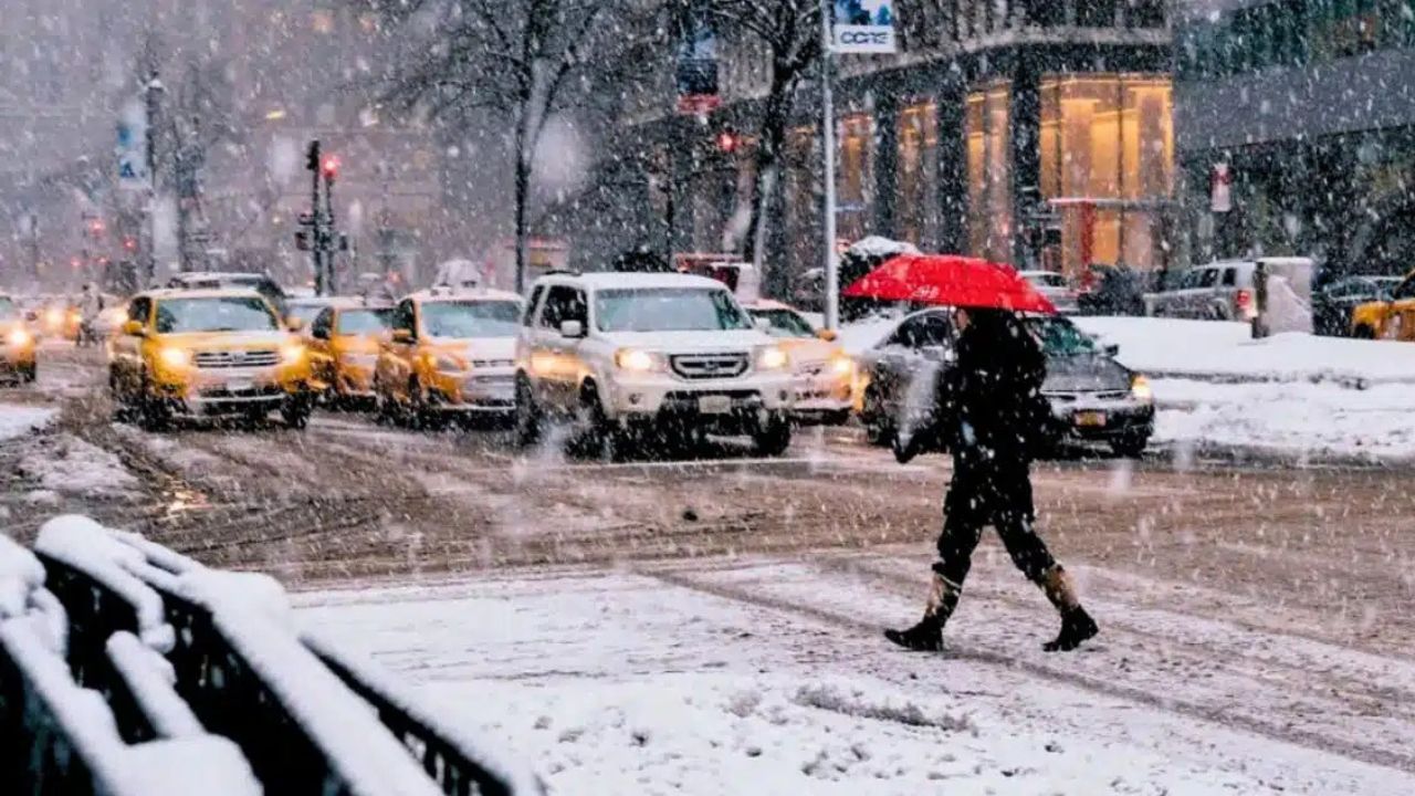
New York, New York — A sharp shift toward true winter conditions is setting up across the New York–New Jersey region, where snow squalls, falling temperatures, and a growing flash-freeze threat could make travel hazardous from late Friday through early Monday.
What may begin as light snow and damp pavement is expected to escalate as Arctic air pushes deeper into the Northeast, allowing snow to accumulate quickly and refreeze after brief melting.
Cold air sets the stage for rapid changes
According to the National Weather Service, colder-than-normal air is already settling over the region, creating an environment where even short bursts of snow can cause immediate problems.
Snow squalls — fast-moving, intense bands of snow — are expected to develop at times through Friday, with a more organized winter system becoming increasingly likely from Saturday into early Monday.
“Snow squalls can reduce visibility to near zero in minutes,” forecasters warned, “And road conditions can deteriorate very quickly.”
Snow squalls pose sudden travel danger
Across New York State, lake-effect snow continues east of the Great Lakes while gusty winds push Arctic air southward. These ingredients raise the risk for sudden whiteouts, especially during snow squalls.
Major travel corridors including I-95, the Cross Bronx Expressway, and the Hutchinson River Parkway could see rapidly changing conditions, with slick pavement forming before drivers have time to react.
Snow squalls are especially dangerous because they often strike with little warning.
New York City turns sharply colder Saturday
In New York City, temperatures are expected to plunge heading into the weekend.
Saturday will feel significantly colder, with daytime highs struggling to reach the upper teens, well below typical January levels. While daytime snow chances remain limited early, conditions are expected to change quickly after sunset.
Snow becomes more likely Saturday night, with the highest chances extending into Sunday and Sunday night.
Read Also: Arctic Cold Front Brings Snow Chances and Dangerous Wind Chills to Cheyenne Area
Flash freeze risk increases overnight
Forecasters warn that flash freezing will be a major concern as snow falls into bitter cold air. Even light accumulations could freeze solid on contact with untreated roads, bridges, sidewalks, and parking lots.
“Any moisture left on surfaces can turn to ice rapidly once temperatures drop,” the weather service cautioned.
By early Monday, snowfall chances gradually diminish, but dangerous cold remains in place, allowing slush and runoff to refreeze after dark.
Bitter cold lingers into early next week
While snow chances ease Monday, temperatures are expected to stay well below average. Officials warn that icy conditions could persist into the morning commute, even where snowfall has ended.
Residents are urged to limit unnecessary travel during heavier snow periods, keep mobile devices charged, and ensure pets and vulnerable individuals are protected from the cold.
More advisories likely
Meteorologists say additional weather advisories or warnings may be issued as confidence increases in the timing and intensity of snow squalls and weekend snowfall.
Officials encourage residents across New York and New Jersey to stay weather-aware, monitor updated forecasts, and be prepared for sudden changes.
Five-Day Outlook For New York City
- Friday: Mostly sunny and breezy. High near 32°F
- Saturday: Cold and mostly sunny. High near 19°F
- Saturday Night: Snow develops after midnight. Low near 18°F
- Sunday: Snow likely. High near 23°F
- Monday: Chance of snow early, then partly sunny. High near 26°F
Are you planning to travel this weekend? Share what conditions look like in your area and how you’re preparing in the comments below.