
Nashville, Tennessee — A massive and historic winter storm is sweeping across the United States, bringing catastrophic ice accumulation in the South and heavy, disruptive snowfall across large portions of the Midwest and Northeast.
Known as Winter Storm Fern, the sprawling system is expected to impact more than 230 million people nationwide, with dangerous travel conditions, prolonged power outages, and bitter cold lingering well after the storm itself moves out.
Forecasters say the storm stretches more than 2,300 miles, affecting areas from the Southwest to New England and placing dozens of states under winter weather alerts. Officials warn this will be a long-lasting, multi-day event, not a quick-hitting storm.
Catastrophic Ice Threat in the South
The most dangerous impacts are unfolding across the South, where freezing rain and sleet are creating destructive ice accumulations. According to the NOAA Weather Prediction Center, ice totals in some areas could exceed one-quarter inch, a critical threshold where tree damage and power outages increase rapidly.
“Catastrophic ice accumulations are possible in parts of the South,” forecasters warned, noting that downed trees and power lines could leave some communities without electricity for several days.
The highest risk zone stretches from Texas eastward into parts of the Tennessee Valley, the southern Appalachians, and the Mid-Atlantic, where ice-laden branches combined with gusty winds may severely damage infrastructure.
Widespread Power Outages and Travel Hazards
As freezing rain coats roadways and bridges, travel conditions are becoming increasingly dangerous. Officials say some roads could become completely impassable, especially in areas experiencing prolonged icing.
Power companies across the region have mobilized additional crews, but restoration efforts may be slowed by continuing precipitation and plunging temperatures.
Residents in ice-prone areas are urged to prepare for extended power outages, especially with Arctic air moving in behind the storm.
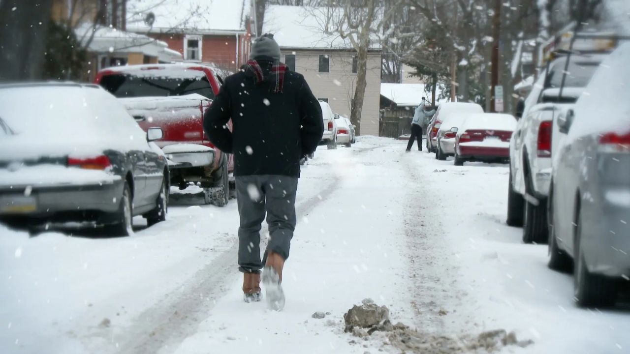
Heavy Snow Blankets Multiple Regions
Beyond the ice zone, heavy snow is spreading across a wide swath of the country. From parts of the southern Rockies and Plains through the Ohio Valley and into the Northeast, at least 6 inches of snow is expected in many locations.
Forecasters say several areas have a strong chance of receiving a foot or more of snow, especially where snow falls steadily over many hours. In southern portions of the heavy snow band, snow may mix with sleet or freezing rain, further complicating travel.
Winter Storm Alerts Widespread
The National Weather Service has issued Winter Storm Warnings and Ice Storm Warnings across large portions of the country.
Winter Storm Warnings indicate a high likelihood of significant snow, sleet, or ice, with power outages and near-impossible travel expected. Ice Storm Warnings signal that freezing rain will be the dominant threat, often leading to the most severe infrastructure damage.
Officials stress that conditions in warning areas could deteriorate quickly, leaving little time to react once precipitation intensifies.
Read Also: Winter Storm Warning Issued As 6–10 Inches Of Snow, Ice Threaten Washington, D.C. Area
Storm Timeline: What to Expect Next
As the storm continues to evolve, impacts will shift region by region.
On Sunday, wintry precipitation is expected to gradually wind down across parts of Texas and the lower Mississippi Valley. However, snow and ice will continue across the Ohio Valley, the Appalachians, and the Northeast, where snowfall rates may intensify.
By Sunday night into Monday, snow is forecast to persist across much of the Northeast. Near the coast, some locations could see snow mix with sleet or change to rain as a coastal storm system strengthens offshore. Farther inland, snow may linger into Monday, particularly across New England and upstate areas.
Meanwhile, rain and thunderstorms could develop across portions of the Southeast, adding another hazard to already saturated and icy regions.
Arctic Cold Will Lock In the Damage
Even after the storm begins to exit, extreme cold will prolong its impacts. A surge of Arctic air is expected to push temperatures well below normal across much of the South, Midwest, and East.
Daytime highs in some ice- and snow-covered areas may remain below freezing until midweek, while overnight lows plunge into the single digits, teens, and 20s.
This deep freeze means any melting during the day could refreeze overnight, creating black ice and extending dangerous travel conditions for days.
For communities dealing with power outages, the cold could become life-threatening, especially for vulnerable populations.
A Long Recovery Ahead
Officials emphasize that Winter Storm Fern is not just about what happens during the storm, but what follows. Snow removal, power restoration, and cleanup efforts could take days, if not longer, in the hardest-hit areas.
Residents are urged to avoid unnecessary travel, prepare emergency supplies, and check on neighbors as conditions evolve.
How is Winter Storm Fern affecting your area right now? Share what you’re seeing and how you’re preparing in the comments below.


